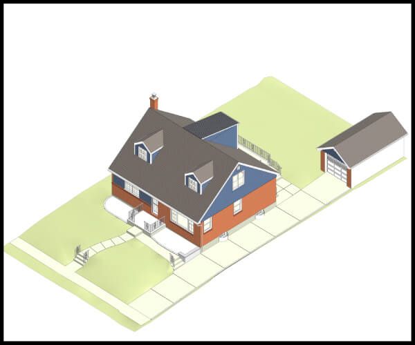
This single-family home is located at 24 Greentree Rd, Mineola, NY. 24 Greentree Rd is in Mineola, NY, and in ZIP code 11501. This property has 2 bathrooms and approximately 1,470 sqft of floor space. This property has a lot size of 5201 sqft and was built in 1953.
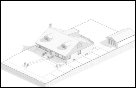
Revit BIM 3D modeling Project of 24 Greentree Rd, Mineola, NY

- Project Name :Revit BIM 3D modeling of 24 Greentree Rd, Mineola, NY. 11501
- Project location :24 Greentree Rd, Mineola, NY, 11501
- Scope of work :Laser Scan to BIM LOD 450 Revit Modelling with Documentation
- Trades covered :Architectural, Structural, MEP, Electrical, and Plumbing
- Resources :2 BIM experts
- Software used :Revit
- Time Duration :10 Days


Project Overview
Role Of BIM Modeling In The Project
BIM Modelling played the most vital role in this project. The entire project was based on the Revit BIM model executed by the Revit software. The accurate as-built drawings that we produced in front of the clients were of high quality. BIM can enhance the project value and provide additional depth to it, and it did the same for this project too.
Why do they need our service?
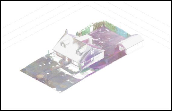
24 Greentree Rd.’s architect provided us with the point cloud file. We were asked to create the Architectural, Structural, and MEPF drawings. All the drawings were supposed to be produced using the raw point cloud data that they provided initially.
Challenges
The quality of the point cloud data was inferior. We were supposed to create as-built drawings using the smallest of details. We did take the image reference sent by the client along with the Google Earth images to create every fine detail for the exterior elevation of the project.
We also created a complete as-built drawing set with annotations. We even annotated each duct size and bottom height from the floor level. in the mechanical drawings. It was difficult to work with the ineligible point cloud data and match those in LOD450. But we overcame that challenge by trying to get the best view of the point cloud and replicate the exact details of the size and everything in the as-built drawing. We did our best to bring the model to the most realistic self.
What Did COPL Members Take Away From The Project?
We had a great experience while working on this project. This particular project challenged our skills and pushed our limits. But in the end, it was worth it. Working on a complicated project is always an opportunity for us as it enhances our skillset and horizon of experience. We learned how to work past our challenges and excellently present the work to our clients.
Benefits to Clients from Revit BIM Modeling/Results
The 24 Greentree Rd. clients received the most accurate as-built drawing that their plan needed. Their cloud data needed more fine detailing. We took that challenge and converted that into an opportunity to provide exceptional quality work. The final results surpassed the clients' expectations and they were grateful for the drawings they received.
Contact Us
for project discussion
Once you fill out this form, our sales representatives will contact you within 24 hours.
12+
Years of Experience
30+
In-House Talent
750+
Project Delivered
95+
Client satisfaction rate
